Rainfall distribution in West Asia
Shared groundwater aquifers in the Arabian Peninsula
Water dependency ratio by country
Water stress parameter (RSs) for the year 2005
Coefficient of Variation (CV) of precipitation for West Asia
Water variation parameter (RSv) for West Asia
Aerial coverage of water exploitation pressure (DPs)
Safe drinking water inaccessibility parameter (DPd) for the year 2005
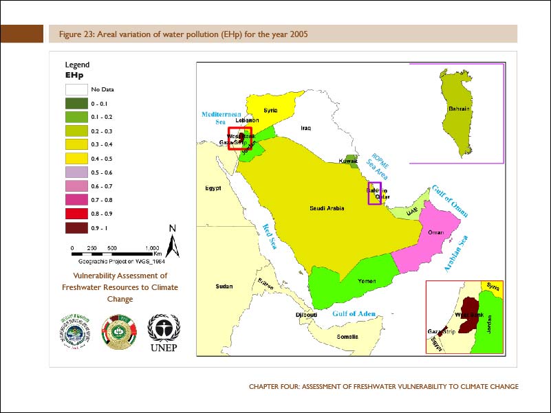
Aerial variation of water pollution (EHp) for the year 2005
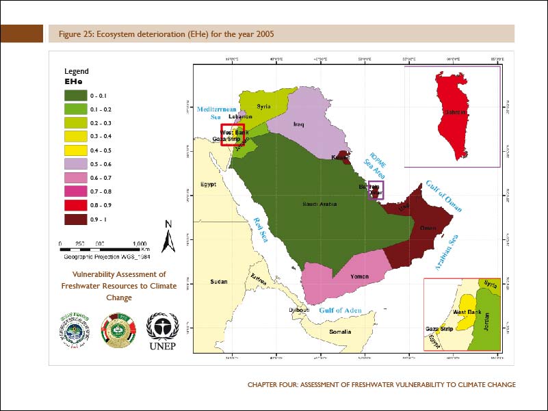
Ecosystem deterioration (EHe) for the year 2005
Water use inefficiency coverage for the year 2005
Improved sanitation inaccessibility parameter (MCs) for 2005
Conflict management capacity parameter (MCg), year 2005
The Euphrates and Tigris river basins and their drainage networks
Isohyetal map for the Euphrates River basin
Normalized Difference Vegetation Index values for the Euphrates River (1999-2007)
Euphrates basin Vulnerability Index map, 2000
Aerial coverage of Palaeogene formations in West Asia including the Dammam Aquifer
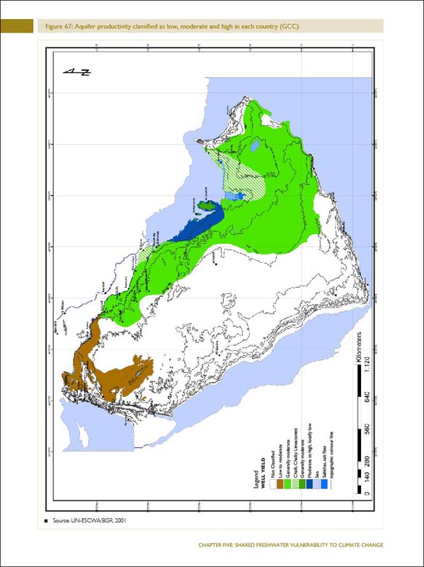
Aquifer productivity classified as low, moderate and high in each country (GCC)