
Page 7 - Mauritius REPORT
P. 7
The situation
The coastal ecosystems of Mauritius island include rocky shores, lagoon corals, seagrass beds,
mangroves and other related marine life. Fringing reefs surround most of the volcanic island enclosing
a lagoon of about 243 km ranging in depth from 1 to 4m. The range of ecosystems support a wide
2
variety of flora and fauna. The lagoons support a commercial fishery. Fish and shellfish culture Country Profile
is practiced in enclosed ponds (barachois); and other anthropogenic factors have contributed to
reef stress and degradation. A rich algal biomass is present which shows seasonal variation. Two The Republic of Mauritius
species of mangroves, Rhizophora mucronate and Bruguiera gymnorrhiza exist (Fagoonee, 1990)
(MAIFS, 2017). There are over six species of seagrass beds including Entromorpha, Ulva, Sargassum,
Caulerpa sp.Padina and Halimeda and these cover an estimated area of 55 ha to 649 ha (ASCLME,
2012) Other species marine invertebrates such as crabs, shrimps, lobsters, sea cucumbers, molluscs
and octopus however these species have not been extensively studied or researched on.
The constraints
Coastal population growth
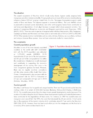
Figure 1: Population density in Mauritius
Mauritius is one of the most densely populated
countries in the world with 629 inhabitants/
2
km ; with the 2019 population was estimated
at 1,270,000 people (UNDESA, 2019)
Approximately 27 per cent of its total population
and 50 per cent of its rural population live within
the coastal zone. Infrastructure is well-developed
and contributes to supporting the economic
development of the country. Port Louis is the
main navigational gateway for trade. However,
there are no regular maritime connections
with the other islands of the South West Indian
Ocean. Unemployment is also an issue with the
unemployment rate for 2019 is forecasted at
6.7 per cent compared to 6.9 per cent in 2018
(Statistics Mauritius, 2019).
Tourism growth
Mauritius is well known for its superb and unique beaches There are 95 proclaimed public beaches
making a total of an extent of 3232.466 hectares (Beeharry, Makoondlall-Chadee, & Bokhoree,
2014). The coastal zones across Mauritius have known several developments mostly because of the
number of tourists visiting the island. However, these developments together with natural phenomenon
have contributed to the degradation of these zones. For instance, in 1987 the coastal areas and
mangrove cover was 20 km . By 1994, the cover had decreased (by 30 per cent) to 14 km partly
2
2
due to the expansion of the tourism industry which contributes about 8.7 per cent to the Mauritian
GDP (CBD, 2019). However, there has been much effort put into the mangroves and this has led to
a recovery of the sector as described in box 1
7